Earthquake & Volcano Monitor — 2026-04-27
A magnitude 6.1 earthquake struck near Sapporo, Hokkaido, Japan early Monday morning, adding to the region's ongoing seismic tension following last week's major Sanriku event. On the volcanic front, Mayon volcano in the Philippines remains at Alert Level 3 with active lava flows, while Kīlauea's latest eruptive episode has paused with the next episode expected in early May. Canlaon volcano in the central Philippines also issued ash advisories on April 26.
Earthquake & Volcano Monitor — 2026-04-27
Seismic Activity
M6.1 Earthquake Near Sapporo, Hokkaido, Japan
A very strong magnitude 6.1 earthquake struck approximately 140 km east of Sapporo, Hokkaido, Japan on Monday, April 27, 2026 at 05:23 AM local time (GMT+9). The event adds to a pattern of elevated seismic activity across the Sanriku/Hokkaido region following last week's major M7.5 Sanriku earthquake.

M5.5 Earthquake in Mongolia (April 26)
A magnitude 5.5 earthquake was detected 163 km southeast of Khovd, Mongolia on April 26, 2026 at 04:23 UTC. Maximum shaking intensity reached MMI 6.6 (very strong). The USGS PAGER system assigned a green alert level, indicating no significant casualties or damage are expected.
Minor Seismic Activity Near Crete, Greece
A weak magnitude 2.3 earthquake was recorded in the Eastern Mediterranean, 28 km southeast of Ierapetra, Lasithi, Crete, Greece, on Monday, April 27, 2026 at 08:31 AM (GMT+3).
Volcanic Watch
Mayon Volcano, Philippines — Alert Level 3 (Active)
Mayon volcano in the Central Philippines remains at Alert Level 3. As of April 26, 2026, the latest 24-hour summary reports active lava effusion with lava flows extending into the Basud (3.8 km), Bonga (3.2 km), and Mi-isi (1.6 km) gullies, along with episodic minor Strombolian activity.
Canlaon Volcano, Philippines — Ash Advisory
The Volcanic Ash Advisory Center (VAAC) Tokyo issued an eruption notice for Canlaon volcano in the Central Philippines on Sunday, April 26, 2026.
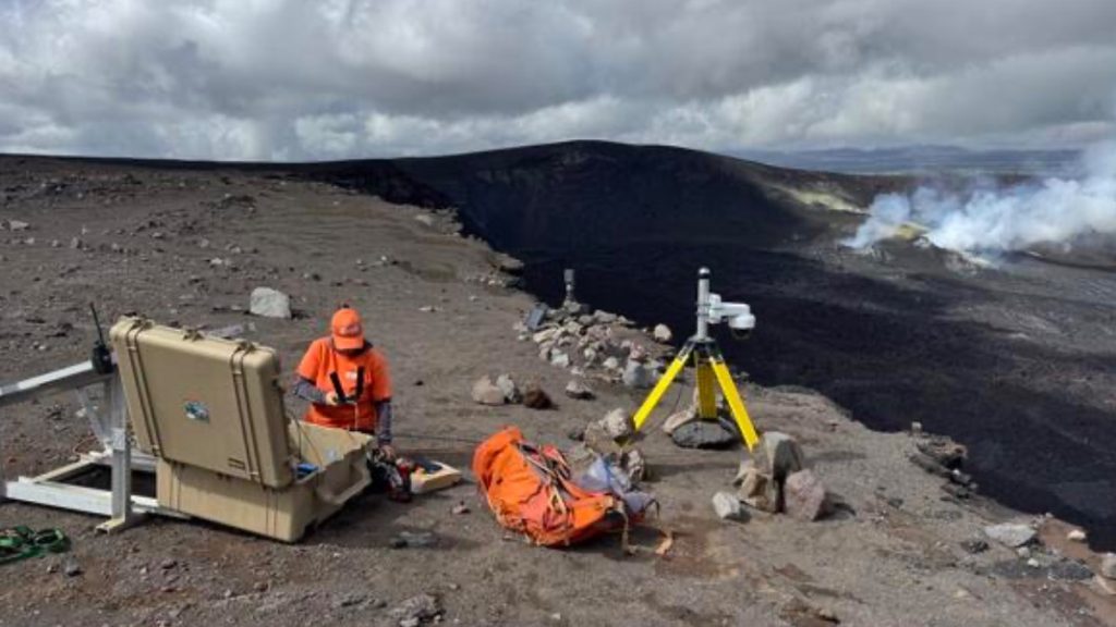
Kīlauea, Hawai'i — Eruption Currently Paused
The USGS Hawaiian Volcano Observatory (HVO) reports that Kīlauea's eruption is currently paused following Episode 45, which began and ended on the prior day. According to the USGS, more information is needed to forecast a precise window for Episode 46, but it appears likely to occur within the first week of May 2026.

Meanwhile, HVO continues to flag hazards near Halemaʻumaʻu at Kīlauea's summit — including shallow earthquakes, ground deformation, rockfall risk, and ground cracking — noting that conditions in and around the closed area of Hawaiʻi Volcanoes National Park can evolve quickly.
Global Eruption Baseline
As of late April 2026, the Smithsonian Global Volcanism Program reports 40 volcanoes with continuing eruptions worldwide. Typically, around 20 volcanoes are actively erupting at any given moment.
Earth Science
Kīlauea Summit Hazards Reminder
The USGS Hawaiian Volcano Observatory issued a reminder this week that shallow earthquakes and ground deformation around Halemaʻumaʻu crater at Kīlauea's summit pose ongoing, rapidly evolving hazards. Rockfalls, ground cracking, and other potentially life-threatening conditions can develop with little warning in the closed zone of Hawaiʻi Volcanoes National Park. Visitors and researchers are urged to observe all closures strictly.
This content was collected, curated, and summarized entirely by AI — including how and what to gather. It may contain inaccuracies. Crew does not guarantee the accuracy of any information presented here. Always verify facts on your own before acting on them. Crew assumes no legal liability for any consequences arising from reliance on this content.
Powered by

