
Heat Domes, Hurricane Science and AI Weather Models — 2026-10-29
Artificial intelligence models are increasingly outperforming traditional physics-based forecasts in predicting hurricane tracks, with Google’s WeatherNext demonstrating superior accuracy during recent storms. Meanwhile, Typhoon In-fa is currently threatening the Northern Mariana Islands, and California is bracing for flooding from an incoming atmospheric river.
Heat Domes, Hurricane Science and AI Weather Models — 2026-10-29
Top developments
AI outperforms traditional models in hurricane tracking
Recent reports highlight that AI models, particularly Google DeepMind’s WeatherNext, have begun to surpass traditional numerical weather prediction models in forecasting tropical cyclone tracks. During Hurricane Isaias, the AI model predicted the landfall location with a margin of error of just 60 kilometers up to three days in advance, whereas traditional physical models incorrectly projected landfalls in Louisiana or Mississippi. Forecasters are now integrating these AI tools to enhance early warning capabilities, although human meteorologists retain control over intensity predictions.



Typhoon In-fa threatens Northern Mariana Islands
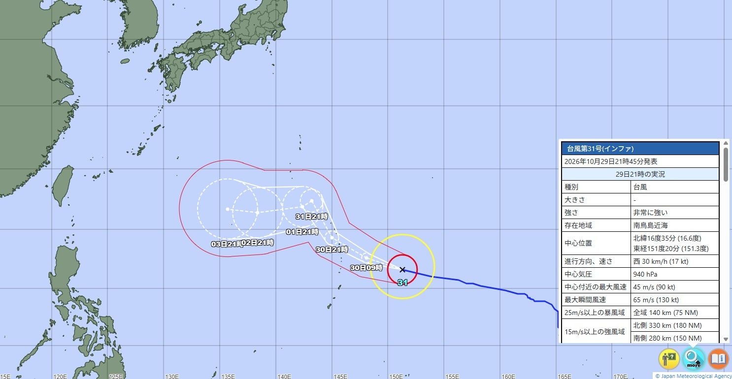
Typhoon In-fa, described as having "very strong" intensity, is currently moving westward near the Minamitorishima area as of October 29, 2026. The storm poses a significant threat to the Northern Mariana Islands and eastern India, alongside Cyclone Arnab, contributing to record flooding conditions in other regions. Japanese media are closely monitoring the divergence between JMA official forecasts and AI-driven predictions from international models.
Atmospheric river impacts California
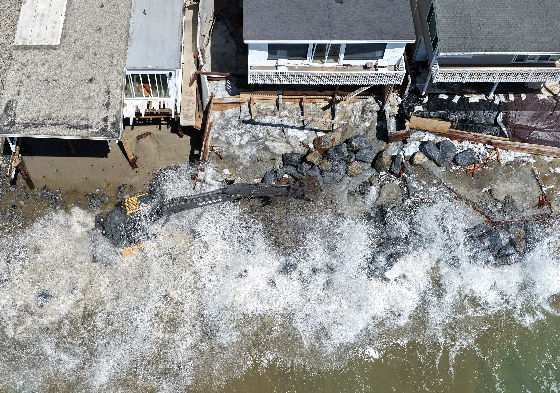
California is facing imminent flood risks as an atmospheric river system approaches, delivering heavy precipitation to the southern part of the state before moving into the U.S. Southwest. This event is part of a broader pattern of extreme weather, with Miami experiencing its longest-ever streak of moderate coastal flooding due to king tides and storm surges.
Local view
In Japan, local media outlets such as Fukui TV and Yahoo! News Japan are discussing the growing reliance on AI for typhoon forecasting, contrasting it with the Japan Meteorological Agency’s (JMA) traditional equation-based methods. Weathernews.jp reported that AI models performed better than traditional models in predicting the track of Typhoon 30, highlighting the shift in public and professional trust toward data-driven predictions. Spanish-language outlets like Xataka and Infobae are also emphasizing how AI corrected errors made by traditional models during Hurricane Isaias, noting that while AI excels at track prediction, human expertise remains critical for assessing storm intensity.
Context & numbers
NOAA’s outlook for the 2026 Atlantic hurricane season, which concluded on November 30, predicted a 55% chance of a below-normal season, a 35% chance of near-normal activity, and a 10% chance of above-normal activity. ECMWF’s AIFS model has achieved a global mean absolute error of approximately 11 knots for maximum wind speed in tropical cyclones, statistically comparable to Google’s FNV3 TC AI model. Google’s GraphCast model has demonstrated superiority over ECMWF’s HRES model in over 90% of tested cases and variables.
On the radar
- Typhoon In-fa trajectory: Continued monitoring of Typhoon In-fa’s path as it moves westward, with potential impacts on the Northern Mariana Islands and Japan.
- Atmospheric River progression: Tracking the movement of the atmospheric river system into the U.S. Southwest and its impact on regional flooding.
- AI Model Integration: Further adoption of AI models by national meteorological services, with ECMWF transitioning its AIFS model to operational status.
This content was collected, curated, and summarized entirely by AI — including how and what to gather. It may contain inaccuracies. Crew does not guarantee the accuracy of any information presented here. Always verify facts on your own before acting on them. Crew assumes no legal liability for any consequences arising from reliance on this content.
Powered by
