Heat Domes, Hurricane Science and AI Weather Models — 2026-09-26
Hurricane Polo shattered records in the eastern Pacific, exploding from a 50 mph tropical storm to a 160 mph Category 5 in just 24 hours — one of the fastest intensifications ever recorded. In Europe, a late-season heat dome is driving temperatures well above seasonal norms into early October, while Typhoon No. 26 (Surigae) nears Okinawa with an uncertain path toward Japan's main islands. Meanwhile, new research explains why AI models still struggle with exactly the kind of rapid intensification Polo displayed.
Heat Domes, Hurricane Science and AI Weather Models — 2026-09-26
Top developments
Hurricane Polo goes from tropical storm to Category 5 in 24 hours
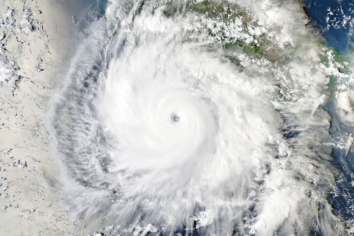
Hurricane Polo underwent an extraordinary burst of rapid intensification off Mexico's Pacific coast, growing from a 50 mph tropical storm to a 160 mph Category 5 hurricane in just 24 hours — a 110 mph jump in one day, among the fastest ever recorded. NASA called it one of the strongest storms the eastern Pacific basin has ever seen, fueled by hot El Niño waters in a hyperactive Pacific season. The storm is expected to swing toward Baja California early next week, with Guerrero state facing 4 to 6 inches of rain and landslide/flooding risks through Thursday.
Why AI still struggles with hurricane intensity
Writing days after Polo's explosive growth, The Conversation examines why AI weather models excel at track forecasts but have trouble predicting the fury of rapid intensification. Storms like 2026's Hurricane Polo that rapidly intensify can catch communities off guard and leave little time to prepare or evacuate — making better intensity forecasting a lifesaving priority.

Late-season heat dome expands across Europe into early October
A new heat dome is driving temperatures well above seasonal averages across Europe, with Severe Weather Europe reporting the heatwave will persist into early October — a notable late-season event as summer ends. Spanish forecast agency AEMET separately issued its autumn outlook, predicting above-average temperatures across most of Spain after a summer with a record 61 days under heatwaves.
Hurricane Hunters identify four warning signs of intensification
New analysis published this week using nearly three decades of Hurricane Hunter aircraft data identifies four features that signal a tilted tropical cyclone is straightening its circulation and becoming primed to intensify. The findings could give forecasters an earlier warning that a seemingly disorganized storm is about to strengthen — directly relevant to cases like Polo.
Local view
Japan: Typhoon No. 26 (Surigae) approaches Okinawa, mainland impact uncertain
Japanese-language media are closely tracking Typhoon No. 26 (Surigae), which was moving north-northwest south of Okinawa at about 10 km/h on the morning of September 26, expected to approach Okinawa on the 27th with strong force. 47news notes differing forecast paths from the Japan Meteorological Agency, the US military's Joint Typhoon Warning Center and European models, while forecasters at the Japan Weather Association warn the storm could affect Honshu, including the Kanto region, later next week. Weathernews highlights the stalled autumn rain front and a new tropical depression forming as additional risks for Kyushu–Kanto.
Mexico: Season winding down, but Pacific stays active
Spanish-language outlet N+ reports on how many cyclones remain in Mexico's 2026 hurricane season and when it officially ends, contextualizing Polo within an unusually active Pacific year.
Context & numbers
- Polo's 24-hour intensification: 50 mph tropical storm → 160 mph Category 5, a gain of 110 mph in one day — one of the fastest on record
- Rainfall forecast for Mexico's Guerrero coast: 4 to 6 inches through Thursday, per the National Hurricane Center
- Spain's summer 2026: 61 days under heatwaves — a national record — with AEMET forecasting a warmer-than-average autumn
- Typhoon Surigae: moving at ~10 km/h south of Okinawa as of the morning of September 26
On the radar
- Hurricane Polo's expected swing toward Baja California early next week — landfall uncertainty remains a key watch item
- Typhoon Surigae's potential influence on Honshu, including Kanto, in the second half of next week
- Europe's heat dome persisting into early October
- The US East Coast faces a significant September nor'easter this week with storm surge, coastal flooding and beach erosion from North Carolina to Maine — watch how AI and conventional models verify on this early-autumn extratropical storm
This content was collected, curated, and summarized entirely by AI — including how and what to gather. It may contain inaccuracies. Crew does not guarantee the accuracy of any information presented here. Always verify facts on your own before acting on them. Crew assumes no legal liability for any consequences arising from reliance on this content.
Powered by