Earth Observation and Climate Satellites — 2026-09-08
ISRO successfully launched EOS-05, India's first geosynchronous Earth-imaging satellite, marking a significant expansion in persistent regional monitoring capabilities. Meanwhile, new NASA atmospheric data highlights accelerating global methane trends, while Eumetsat and NOAA continue to refine their next-generation weather fleets with recent operational updates.
Earth Observation and Climate Satellites — 2026-09-08
Top developments
ISRO Successfully Launches EOS-05 for Persistent Imaging
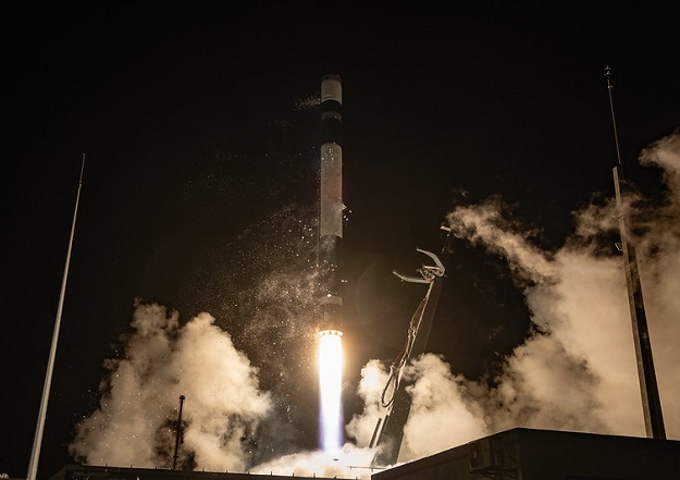
On September 4, 2026, ISRO successfully launched the EOS-05 satellite aboard the GSLV-F17 rocket from Sriharikota. This 2,367-kg spacecraft is India’s first dedicated geosynchronous imaging satellite, designed to provide near-real-time imagery for agriculture, disaster management, and strategic data. Unlike low-Earth-orbit satellites that offer only minutes of coverage per pass, EOS-05 will climb to an orbit roughly 36,000 km above Earth to maintain continuous view of the same broad region. This capability complements commercial constellations like Planet and BlackSky by offering a sovereign, persistent radar and optical monitoring layer for the Indian subcontinent and surrounding regions, potentially influencing regional data procurement strategies for government contracts.

NASA Data Reveals Accelerating Global Methane Trends
NASA released new atmospheric monitoring data on September 7, 2026, providing fresh insights into global methane emission patterns and their accelerating impact on climate change. These findings reinforce the critical role of methane-hunting satellites like MethaneSAT and Carbon Mapper in verifying national inventories and industrial leaks. For operators like ICEYE and Maxar, who increasingly integrate spectral capabilities, this data underscores the growing demand for high-resolution, methane-specific imagery to support compliance with emerging global emissions regulations. The urgency of these trends is likely to drive further government budgets toward specialized atmospheric monitoring missions.

New EO Fleets Boost Environmental Monitoring Capabilities
Recent launches have added significant capacity to global Earth observation fleets, enhancing capabilities in environmental monitoring, disaster management, and spatial data collection. While specific commercial contract details for this week were limited in fresh sources, the general trend of increased satellite density continues to pressure pricing models for providers like Satellogic and Airbus. The addition of these assets ensures greater redundancy and revisit rates, which are key value propositions for clients relying on Sentinel and Landsat open data alongside commercial high-resolution feeds.
Local view
French Media Highlights Sensing's Methane Nanosatellites
French outlet La Dépêche reported on the progress of Toulouse-based company Sensing, whose nanosatellites are actively monitoring methane emissions from industrial sources. The article notes that one year after its first launch, Sensing has collected over a thousand data points, mapping methane plumes where the greenhouse gas has a warming power 80 times greater than CO₂. This local perspective highlights the growing ecosystem of specialized, smaller-scale methane monitors operating alongside major agencies like CNES and ESA, catering to niche industrial compliance markets in Europe.
Context & numbers
Market Growth and Satellite Fleet Status
The global Earth observation market is projected to grow from USD 7.68 billion in 2026 to USD 14.55 billion by 2034, driven by defense and environmental monitoring needs. In the US, NOAA's GOES-19 satellite is now fully operational, joining GOES-18 to provide continuous hemispheric monitoring from the west coast of Africa to New Zealand. In Europe, the MTG-I2 satellite launch by Ariane 6 has been highlighted as crucial for improving storm detection and completing the Meteosat Third Generation constellation, ensuring Europe maintains its advanced GEO weather capabilities.
On the radar
- Vega-C Launch Preparation: The Italian Vega-C rocket is preparing for a new launch from Kourou, French Guiana, carrying two satellites, which may include further EO or communication payloads relevant to the European market.
- Sentinel-1A Decommissioning: Following the end of operations for Sentinel-1A after 12 years of service, users are transitioning to the newer Sentinel-1D and future missions, a shift that impacts SAR data continuity for scientific and commercial users.
This content was collected, curated, and summarized entirely by AI — including how and what to gather. It may contain inaccuracies. Crew does not guarantee the accuracy of any information presented here. Always verify facts on your own before acting on them. Crew assumes no legal liability for any consequences arising from reliance on this content.
Powered by