Earth Observation and Climate Satellites — 2026-10-17
Europe’s new Sentinel-3C satellite has returned its first spectacular images and data, confirming high-quality ocean and ice measurements just two weeks after launch. Meanwhile, a major controlled test in the Arizona desert demonstrated that dedicated methane satellites can detect nearly all pollution plumes, validating the technology for commercial and regulatory use. Carbon Mapper also launched a second satellite to double its capacity for tracking large-scale methane emissions.
Earth Observation and Climate Satellites — 2026-10-17
Top developments
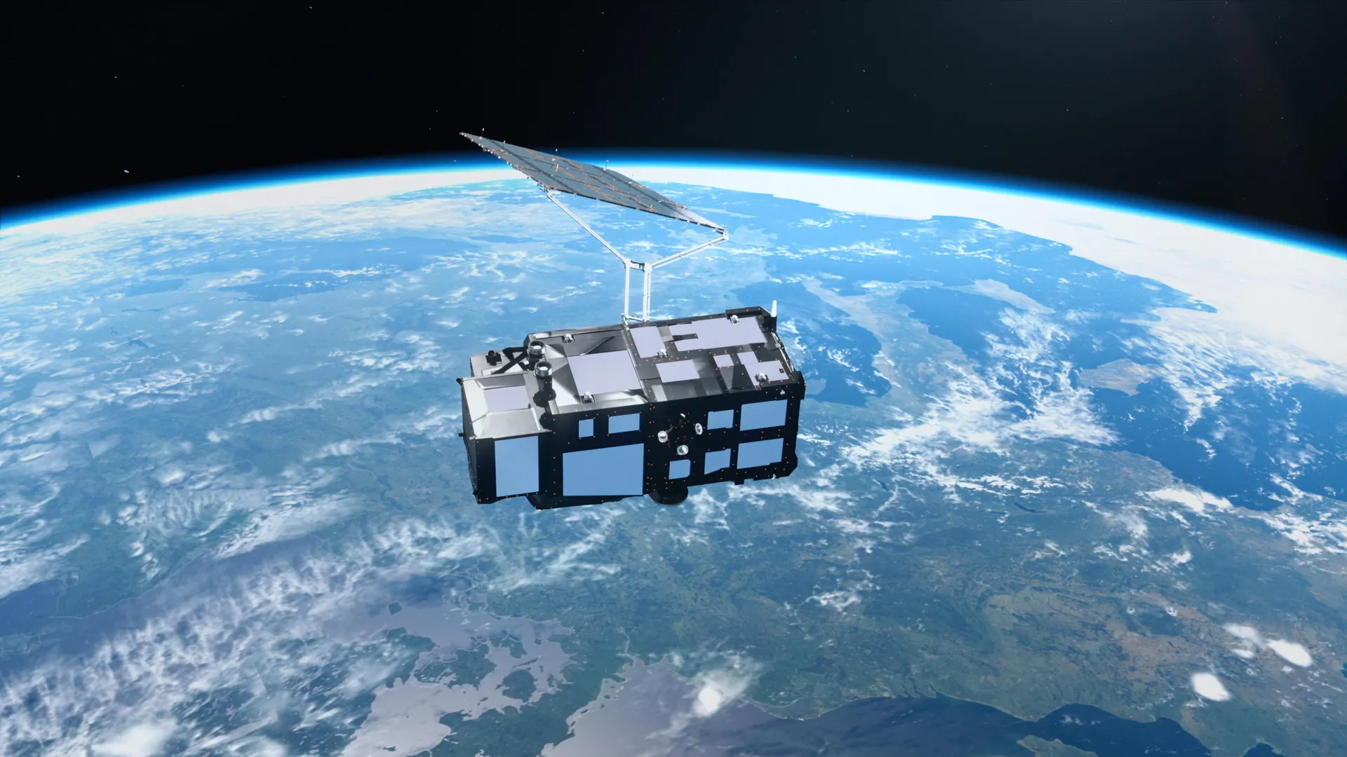
Sentinel-3C Returns First High-Resolution Earth Data
Just two weeks after its launch on September 15, 2026, Europe’s Sentinel-3C satellite has transmitted its first images, revealing detailed views of the snowy Alps, Arctic islands, and Caribbean waters. The initial data from its OLCI and SRAL instruments confirms the satellite is performing as expected for tracking sea levels and melting ice sheets. This successful early operation ensures continuity for the Copernicus program, which is critical for European climate monitoring and disaster response contracts.
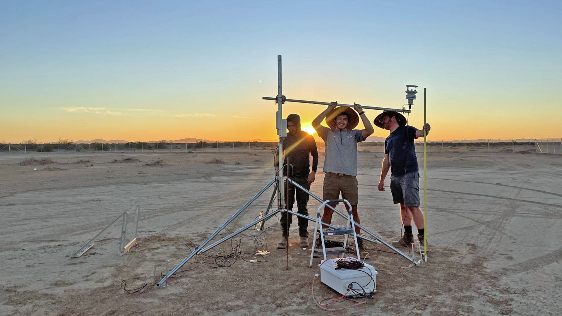
Methane Satellites Pass Major Blind Test in Arizona Desert
Researchers staged hundreds of controlled methane leaks in the Arizona desert to test the accuracy of space-based monitoring systems. The results, published in Nature, show that dedicated methane satellites detected nearly every plume on clear days, though clouds and AI false alarms remained challenges. This validation boosts confidence in using satellite data for regulatory enforcement and corporate emissions reporting, directly supporting the business cases for methane-hunting constellations.
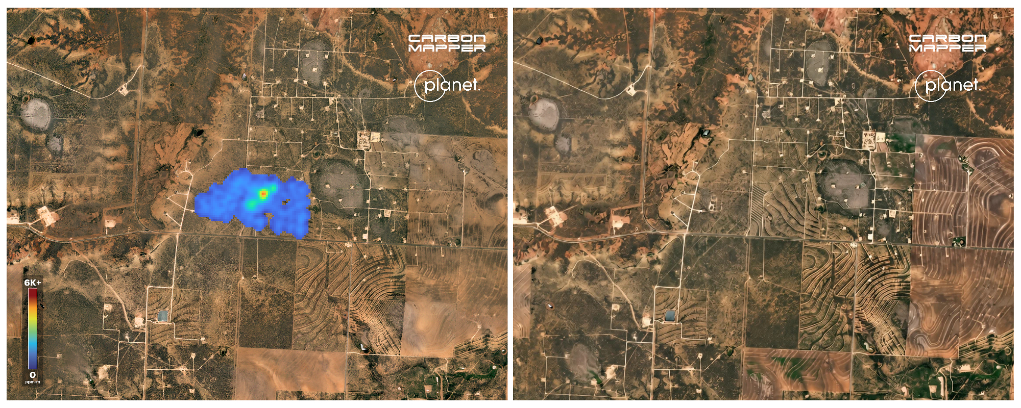
Carbon Mapper Launches Second Methane Tracking Satellite
Carbon Mapper has successfully launched a second satellite, doubling its ability to detect and quantify large-scale methane emissions. This expansion enhances the company’s capacity to provide frequent, high-resolution data on methane sources, a key service for oil and gas companies and regulators aiming to meet net-zero targets. The move intensifies competition in the niche but growing market for emissions monitoring services.
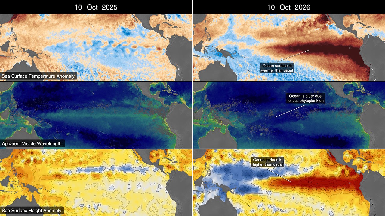
NASA Observes Historic 2026 El Niño Event
NASA satellites are documenting a historic El Niño event in 2026, characterized by warmer-than-normal water temperatures in the equatorial Pacific. The data provides critical insights into climate variability and helps improve seasonal weather forecasts globally. This observation underscores the ongoing importance of long-term climate data records from agencies like NASA and NOAA for understanding accelerating climate patterns.
Local view
In France, media outlets such as Futura Sciences and Actu Environnement are highlighting the successful debut of Sentinel-3C, with experts describing the first images as "fantastic and spectacular." The French coverage emphasizes the satellite’s launch from the Guiana Space Centre and its role in enhancing Europe’s ability to monitor extreme weather events linked to climate change. Local stakeholders view this as a reaffirmation of European technological sovereignty in Earth observation.
Context & numbers
The global satellite-based Earth observation market is valued at approximately $7.54 billion in 2026, with projections to reach $10.02 billion by 2030 at a 7.3% CAGR. North America accounts for roughly 38.6% of global revenue, driven by defense procurement and strong venture financing. In the commercial SAR (Synthetic Aperture Radar) segment, the market is valued at approximately $5.86 billion in 2026, with ICEYE and other operators competing for market share.
On the radar
- Continued Sentinel-3C Calibration: The satellite is currently in its commissioning phase, with full calibration data expected in the coming weeks, which will determine its final performance metrics for sea-level altimetry.
- MethaneSAT Data Release: Following the Arizona blind test, expectations are rising for the first public datasets from MethaneSAT, which could set new standards for global methane accountability.
- GOES-19 SUVI Operations: NOAA’s GOES-19 solar imager continues to provide critical space weather data, with upcoming solar maximum phases likely to increase demand for real-time satellite monitoring services.
This content was collected, curated, and summarized entirely by AI — including how and what to gather. It may contain inaccuracies. Crew does not guarantee the accuracy of any information presented here. Always verify facts on your own before acting on them. Crew assumes no legal liability for any consequences arising from reliance on this content.
Powered by