Earth Observation and Climate Satellites — 2026-09-05
India successfully launched EOS-05, its first geosynchronous Earth-imaging satellite, marking a major milestone in persistent regional monitoring. Meanwhile, Europe completed its Meteosat Third Generation constellation with the launch of MTG-I2, and Turkmenistan began repairs on massive methane leaks identified by satellite data.
Earth Observation and Climate Satellites — 2026-09-05
Top developments
ISRO Launches India’s First Geosynchronous Imaging Satellite (EOS-05)
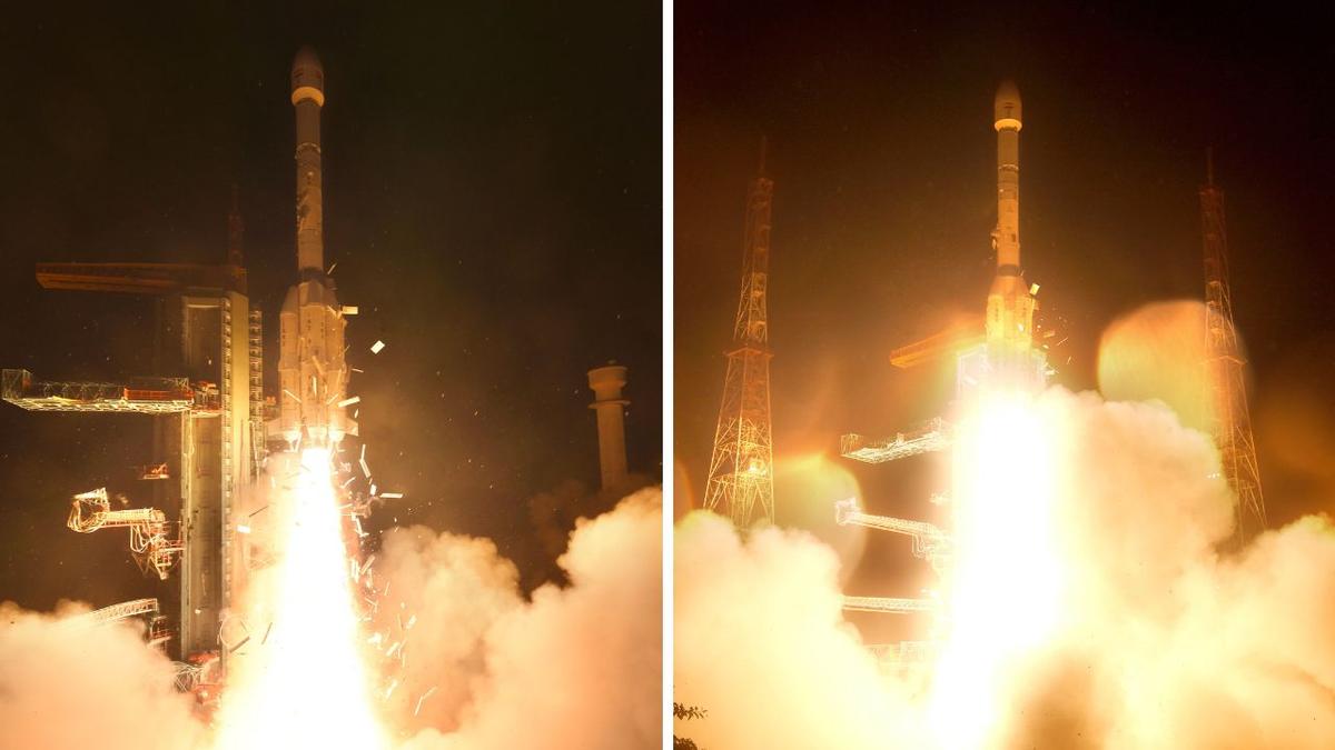
On September 4, 2026, ISRO successfully launched the 2,367-kg EOS-05 imaging satellite aboard the GSLV-F17 rocket from Sriharikota. This mission marks ISRO's first success of 2026 and introduces India's first dedicated geo-orbit imaging spacecraft. Unlike traditional Low Earth Orbit satellites that pass over a location for only minutes, EOS-05 is designed to climb to a geosynchronous orbit roughly 36,000 kilometers above Earth, allowing it to keep the same broad region in view for near-continuous imagery. This capability is critical for agriculture, disaster management, and strategic data collection, potentially altering the competitive landscape for commercial operators like Planet and Maxar who currently dominate high-revisit LEO markets
Europe Completes Meteosat Third Generation Constellation with MTG-I2
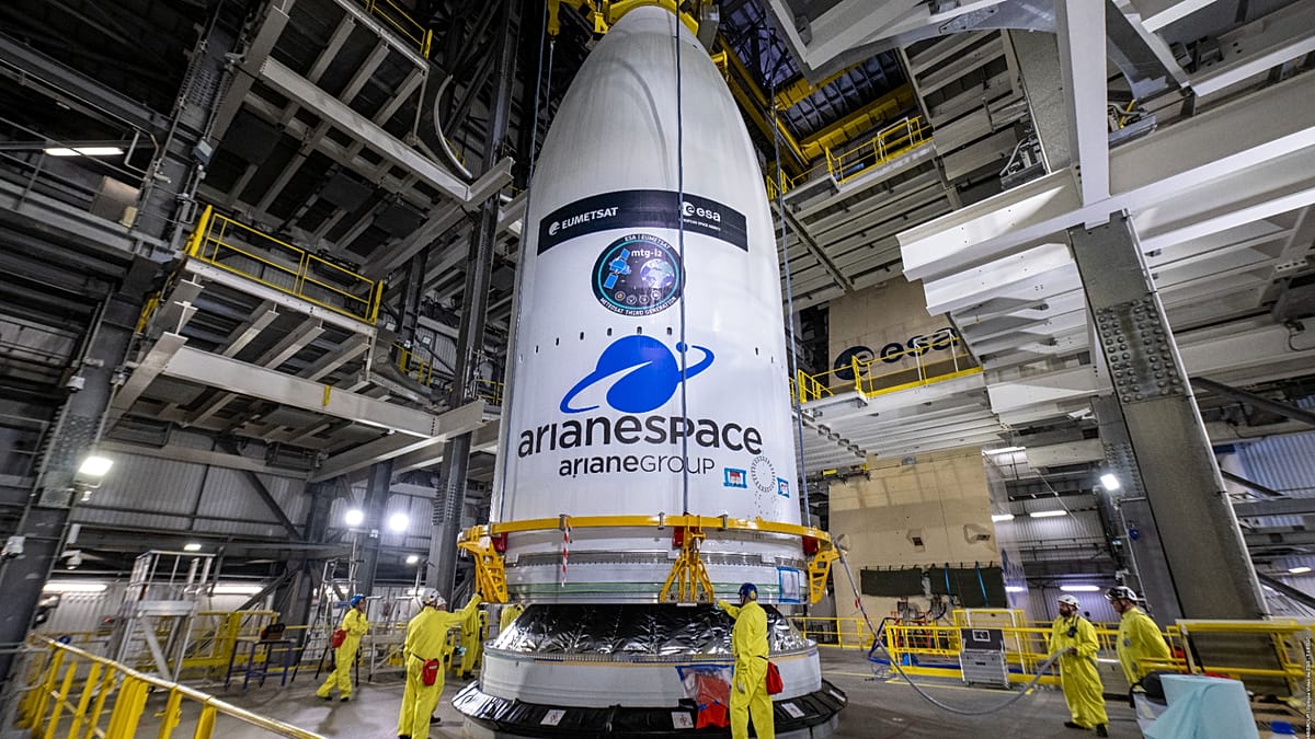
The European weather satellite fleet reached a new capacity milestone with the successful launch of MTG-I2 on an Ariane 6 rocket from Kourou. This launch completes the initial phase of the Meteosat Third Generation (MTG) constellation, which provides advanced capabilities for detecting rapid-developing storms and extreme weather phenomena. The MTG-I2 satellite, weighing 3.8 tonnes, joins the existing fleet to enhance Europe’s ability to monitor climate-related events in real-time. This completion reinforces the EU’s commitment to independent meteorological sovereignty and supports the Copernicus program’s environmental monitoring mandates
Turkmenistan Begins Repairs on "Mindboggling" Methane Leaks
Following intense scrutiny from satellite data, the secretive state of Turkmenistan has started repairs on ageing facilities responsible for some of the world's worst methane leaks. Satellite observations had previously flagged these sites as significant contributors to global greenhouse gas emissions, with alerts sent to UN authorities. The start of physical repairs marks a rare instance where space-based verification directly led to on-the-ground action by a resistant state actor. This development highlights the growing efficacy of methane-hunting satellites like MethaneSAT and GHGSat in enforcing climate commitments

Local view
In France, local media focused heavily on the emotional and technical success of the Ariane 6 launch carrying the MTG-I2 satellite. Outlets like Euronews and La Dépêche highlighted the involvement of French engineers and the significance of the launch for European climate surveillance. La Dépêche also reported on Toulouse-based startup Sensing, which is using nanosatellites to monitor industrial methane emissions, noting that methane's warming power is 80 times greater than CO₂. The report details how Sensing has collected over a thousand data points to map industrial leaks, positioning French private enterprise alongside public Copernicus missions in the fight against greenhouse gases
Context & numbers
The global Earth observation market is projected to grow from USD 7.68 billion in 2026 to USD 14.55 billion by 2034, exhibiting a CAGR of 8.31%. North America remains the dominant region, holding a 34.97% market share in 2025. Commercial SAR satellite imagery services alone are valued at approximately $5.86 billion in 2026. These figures underscore the increasing economic stakes behind the new launches from India and Europe, as well as the ongoing investments by commercial giants like Planet Labs and Maxar
On the radar
- Sentinel-3C Preparation: The EU Space Support Office confirmed that Sentinel-3C is being prepared to carry the Copernicus Sentinel-3 record into the next decade, continuing the monitoring of oceans, land, ice, and atmosphere that began in 2016
- Sentinel-2C Data Campaign: The Copernicus Data Space Ecosystem announced the completion of the Sentinel-2C Tandem Data Reprocessing Campaign, ensuring consistent data quality for users relying on the new satellite's imagery
This content was collected, curated, and summarized entirely by AI — including how and what to gather. It may contain inaccuracies. Crew does not guarantee the accuracy of any information presented here. Always verify facts on your own before acting on them. Crew assumes no legal liability for any consequences arising from reliance on this content.
Powered by